
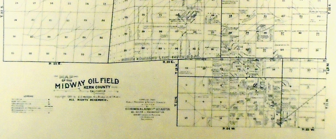
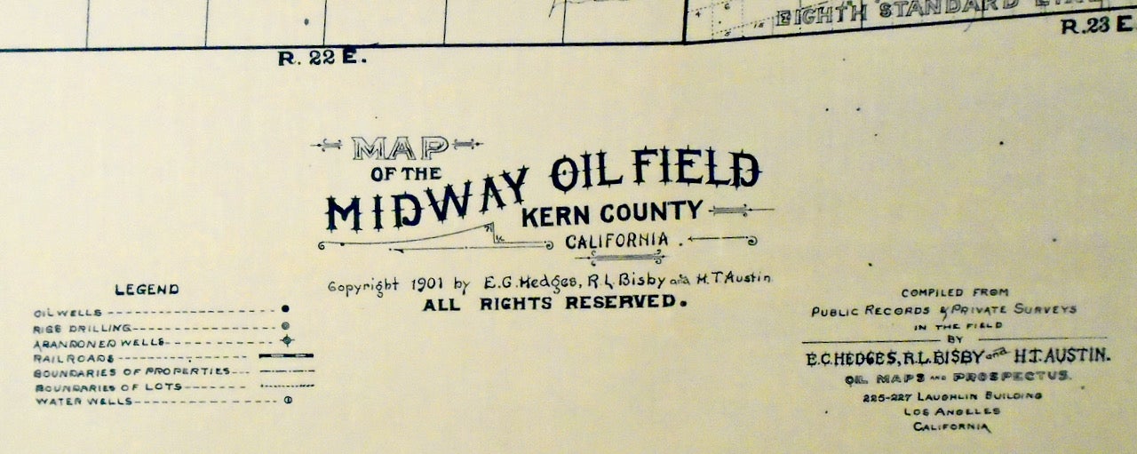
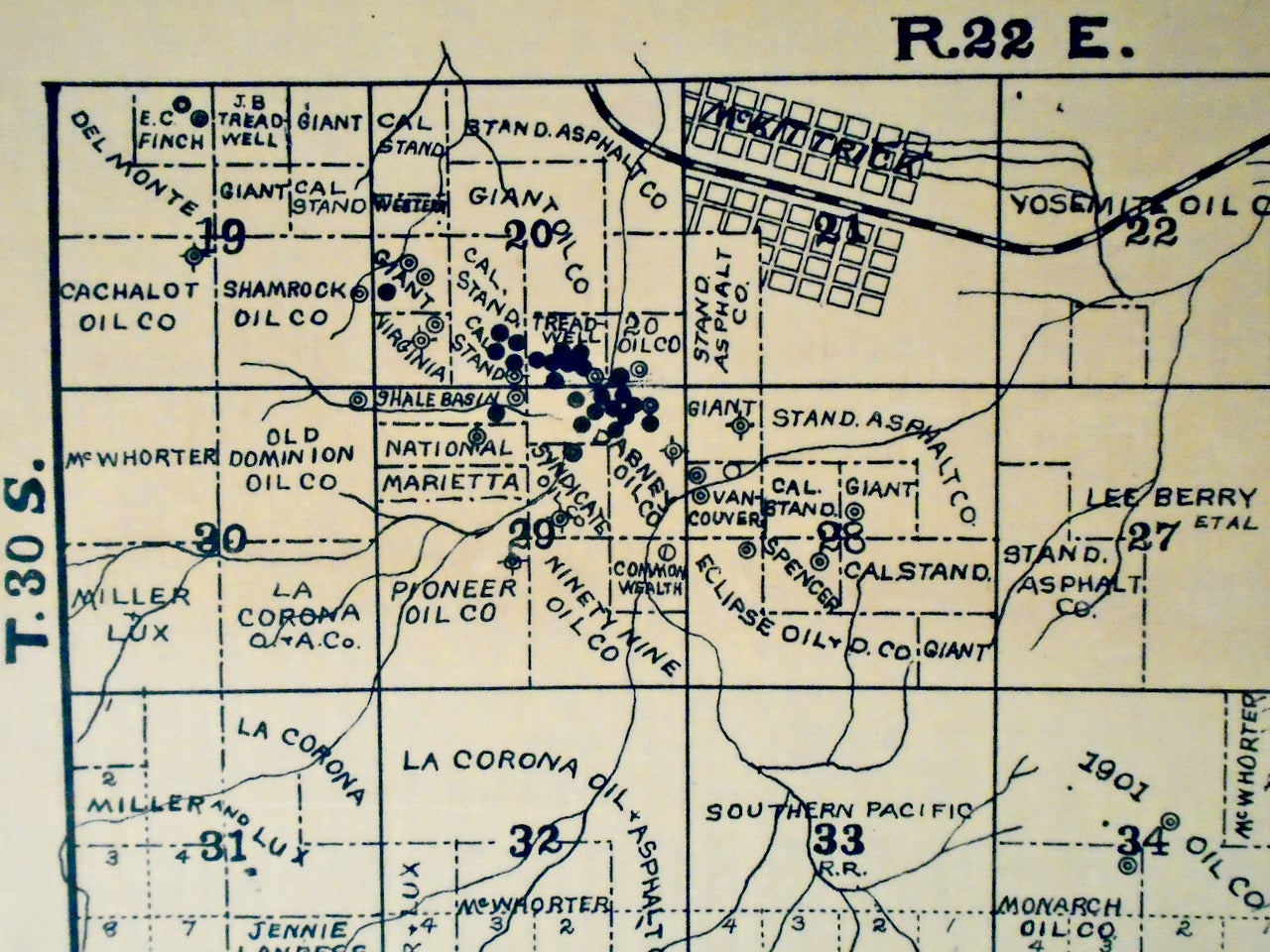
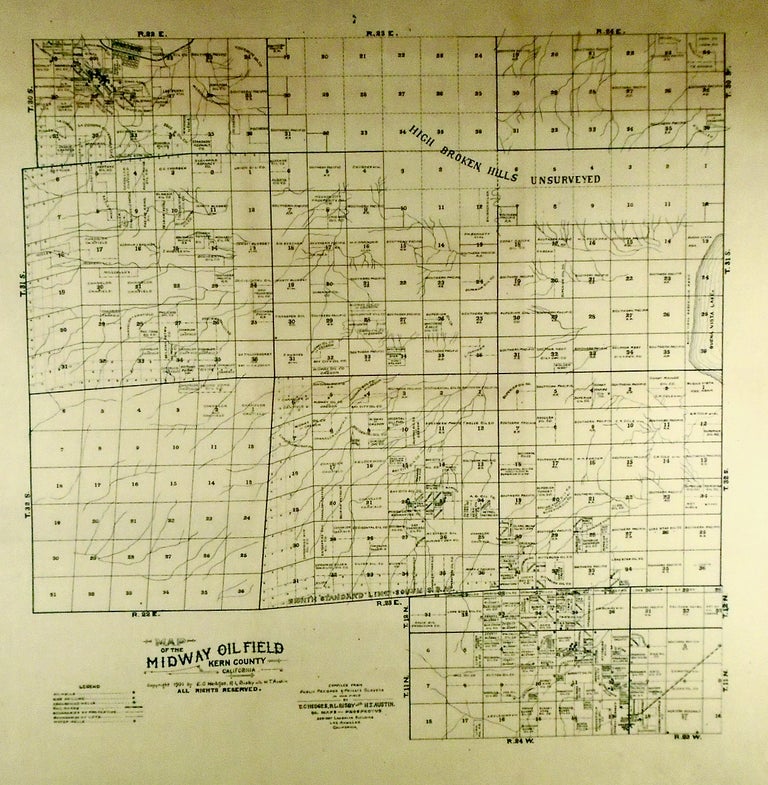
1901“MIDWAY OIL FIELD” ORIGINAL MAP KERN COUNTY, CALIFORNIA. LINEN-BACKED
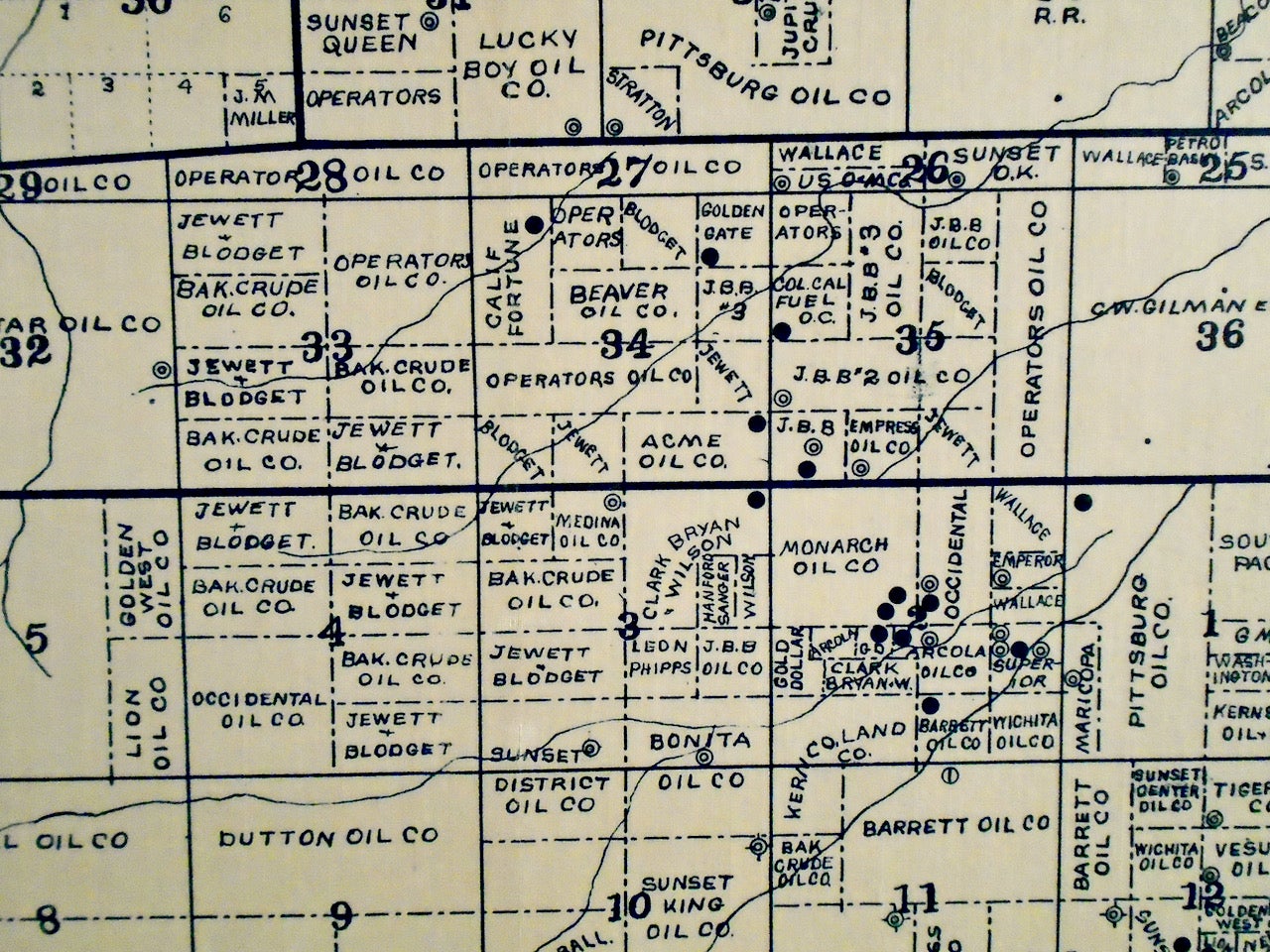
Los Angeles: Oil Maps and Prospectus, 1901. This is an ORIGINAL MAP, 1901, of the MIDWAY OIL FIELD, Kern County, California. It has been expertly LINEN-BACKED. Compiled from public records and private surveys by E. C. Hedges, R. L. Bisby and H. I. Austin. Exceedingly rare. Blueprint. Image approximately 33 1/4" x 32" with a small linen border. The Midway Oil Field (Now, Midway-Sunset Oil Field) was discovered in Kern County in 1894.This map predates the establishment of Taft, California. It is the largest oil field in California. It has produced over 3 billion barrels of oil to date, with substantial reserves still in the ground. This map shows that, as of 1901, relatively few wells had been drilled. It was not until 1909 that the first gusher (oil blown over the derrick top) came in to Midway Field Well 2-6. A Fine linen-backed copy, rolled for shipping. FREE SHIPPING to any United States address. Fine, Linen-Backed. Item #2664
Price: $575.00