

1855 / ORIGINAL MAP: "FROM SAN FRANCISCO BAY TO THE PLAINS OF LOS ANGELES". LINEN-BACKED
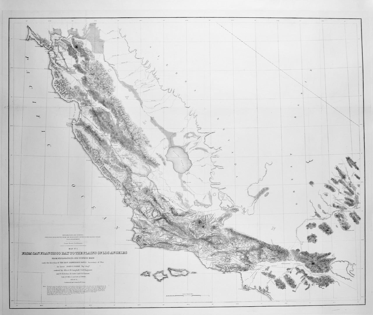
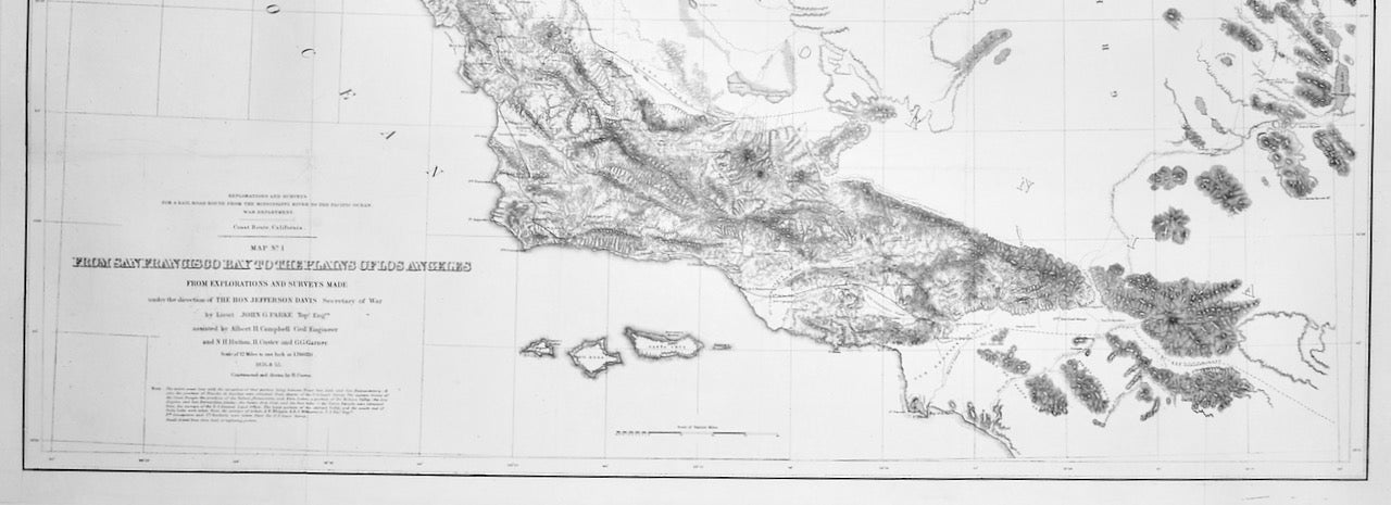
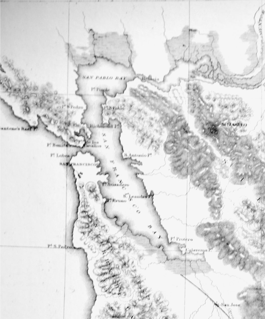
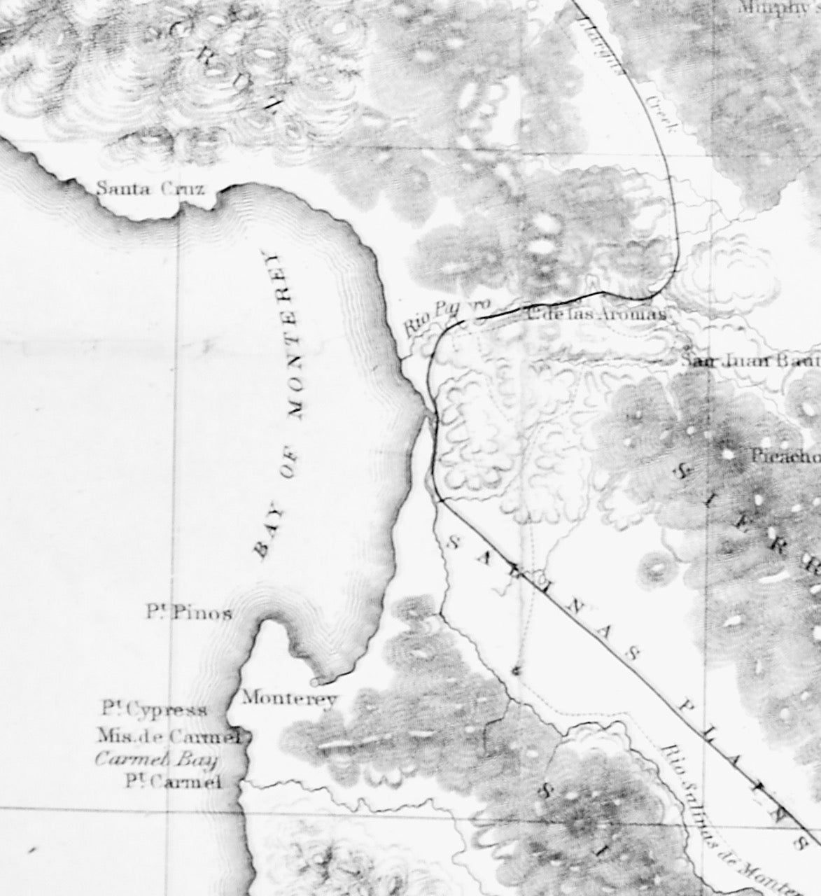
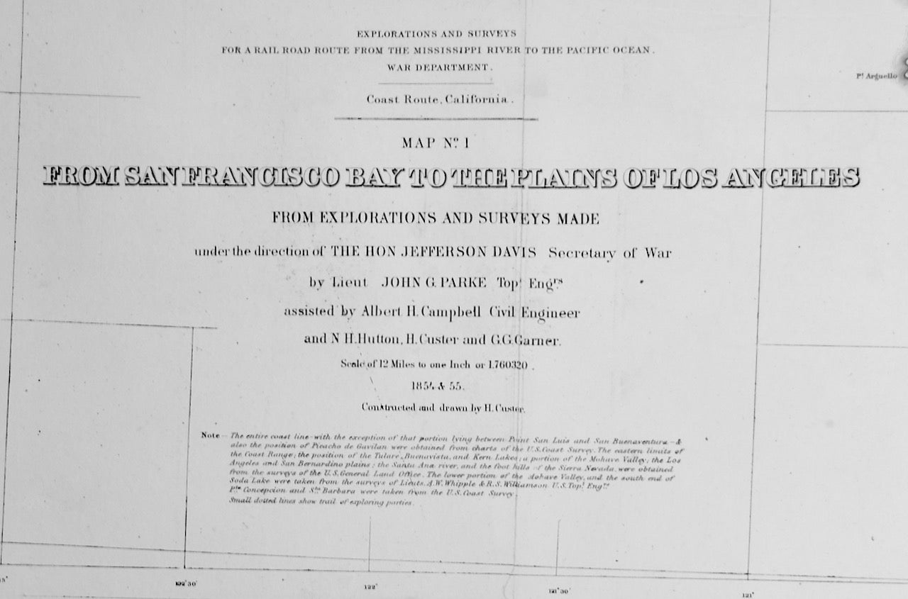
Washington DC: U. S. War Department, 1855. First Edition. This is an original MAP entitled "FROM SAN FRANCISCO BAY TO THE PLAINS OF LOS ANGELES. From the "Explorations and Surveys for a Rail Road Route From the Mississippi River to the Pacific Ocean / War Department". The explorations and surveys were made in 1854-5 under the direction of the then Secretary of War Jefferson Davis (later, President, Confederate States of America). Lithographed map. Expertly Linen-backed for ease of handling and restoration. Image 30" x 36" with 1 3/4" linen border. Shows the central California coast extending to the foothills of the Sierra Nevada. Extracted from Volume XI of the quarto edition of the Pacific Railroad Reports. NOTE: This is an ORIGINAL map; not a copy or reproduction. Wagner-Camp 261. Wheat, Transmissippi 852. Near Fine with minor restorations. FREE SHIPPING to any United States address. Near Fine. Item #2723
Price: $450.00