
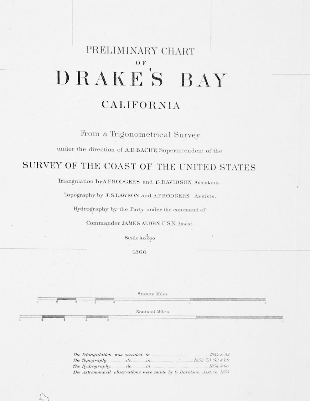
DRAKE'S BAY CALIFORNIA: ORIGINAL MAP 1860 LINEN-BACKED
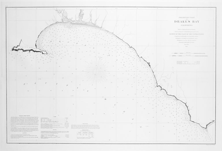
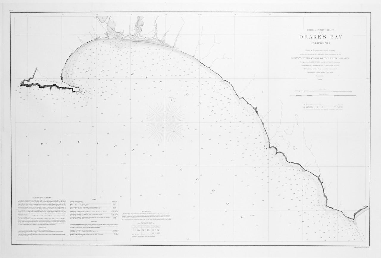
Washington DC: U.S. Coast Survey, 1860. This is an ORIGINAL map entitled "PRELIMINARY CHART OF DRAKE'S BAY CALIFORNIA". 1860. "From a Trigonometrical Survey under the direction of A. D. Bache, Superintenent of the SURVEY OF THE COAST OF THE UNITED STATES." Triangulation (1854-59) by A. F. Rogers and G. Davidson. Topography (1852-3; 1859-60) by J. S. Lawson and A. F. Rodgers. Hydrography (1854 and 1860) by a party under the command of Commander James Alden, U.S.N.. Scale:1/40,000. Drake's Bay is in Marin County, California. It is considered to be the most likely landing spot of Sir Francis Drake during his circumnavigation of the world in 1579. Expertly linen-backed for preservation and ease of handling. 21" x 31" plus 2" white border. A Fine copy.s. Fine. Item #2727
Price: $350.00