

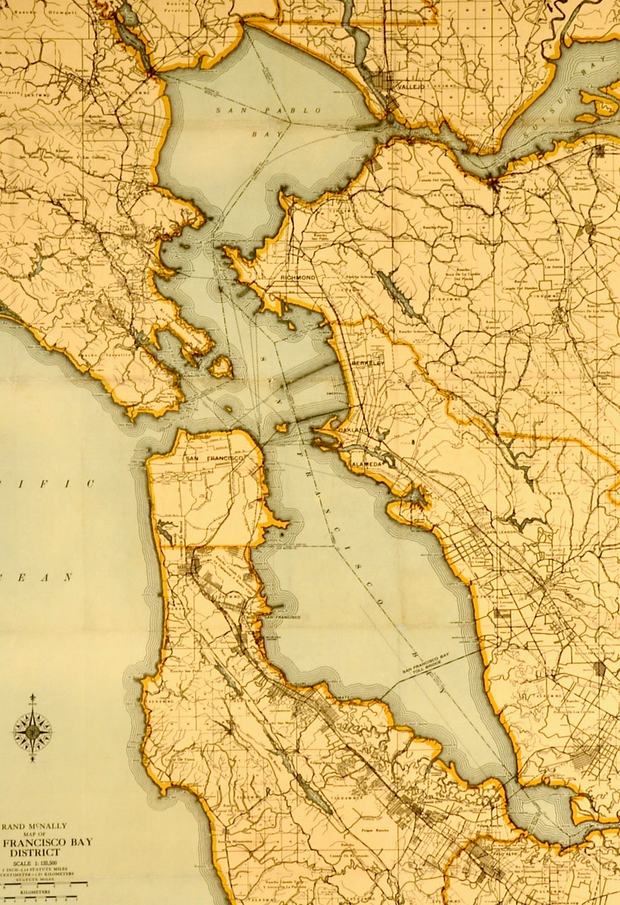
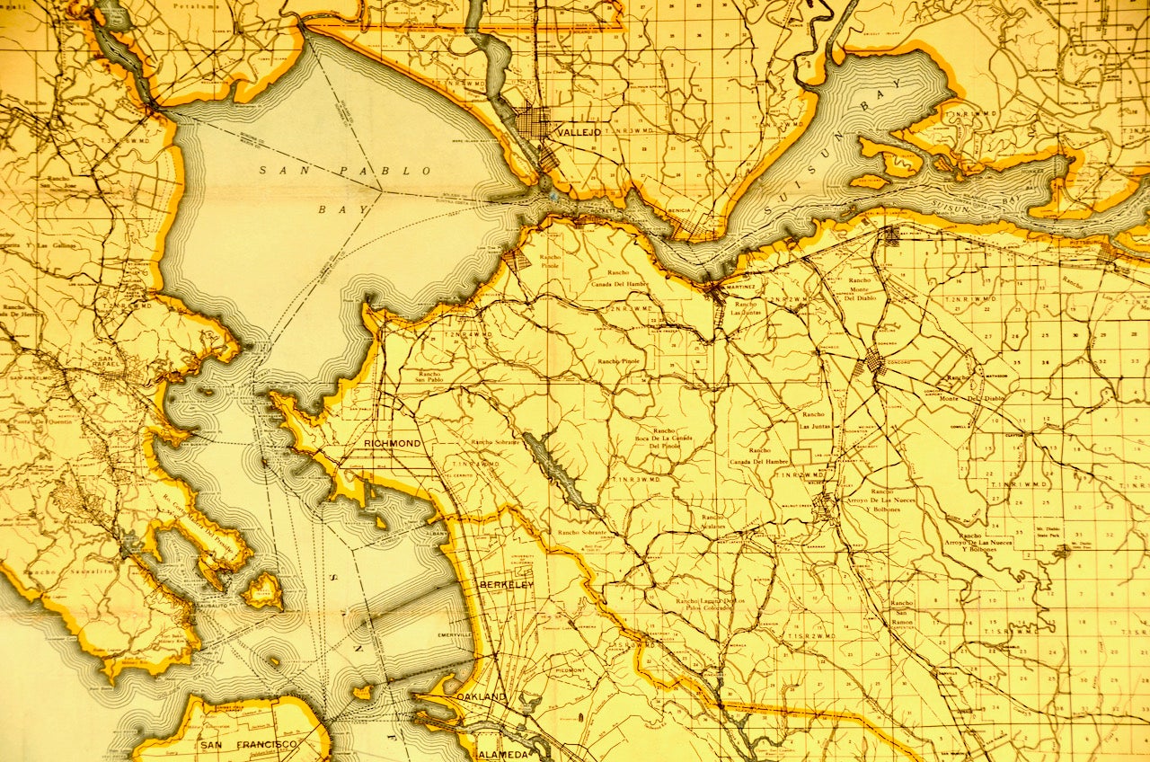
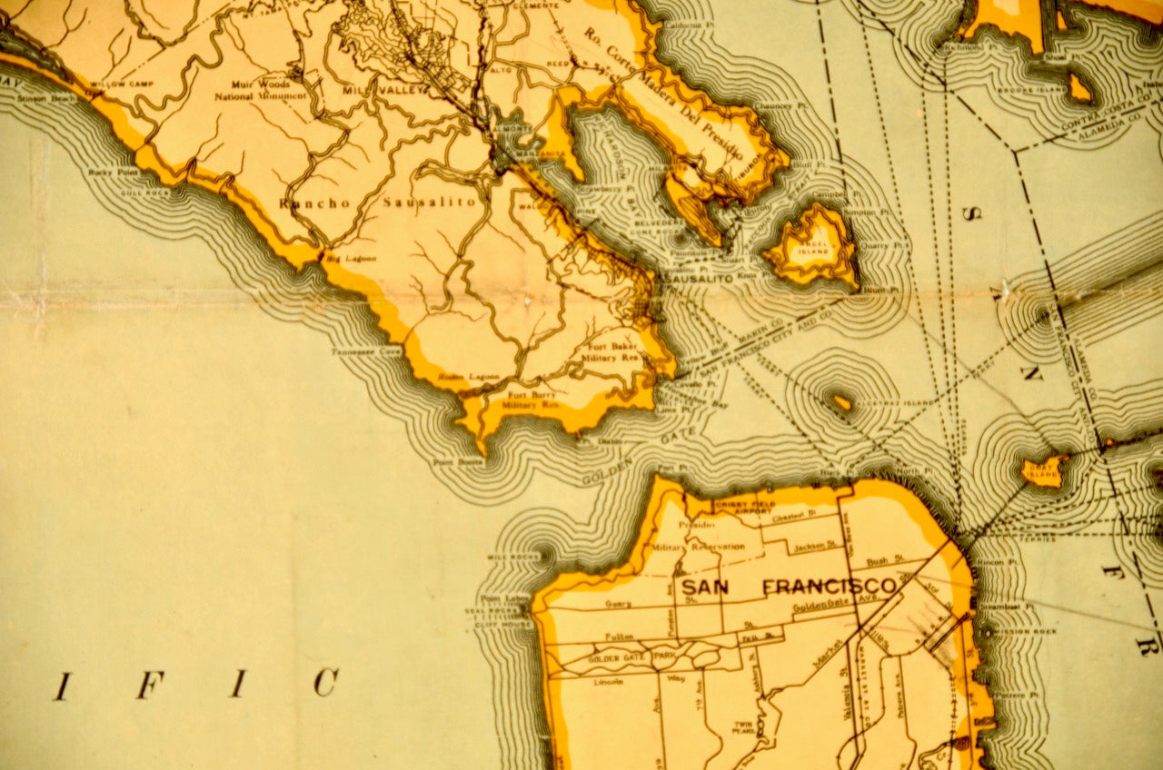
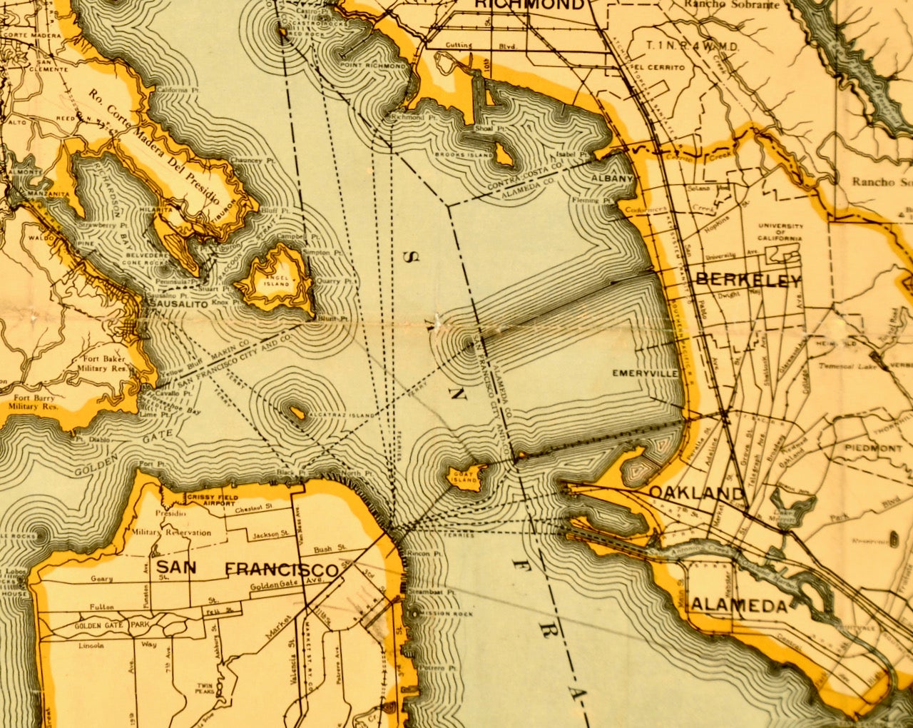
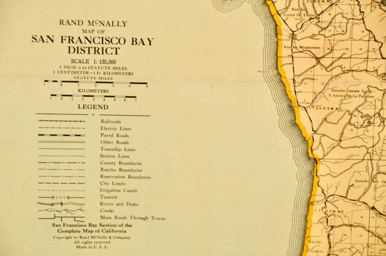
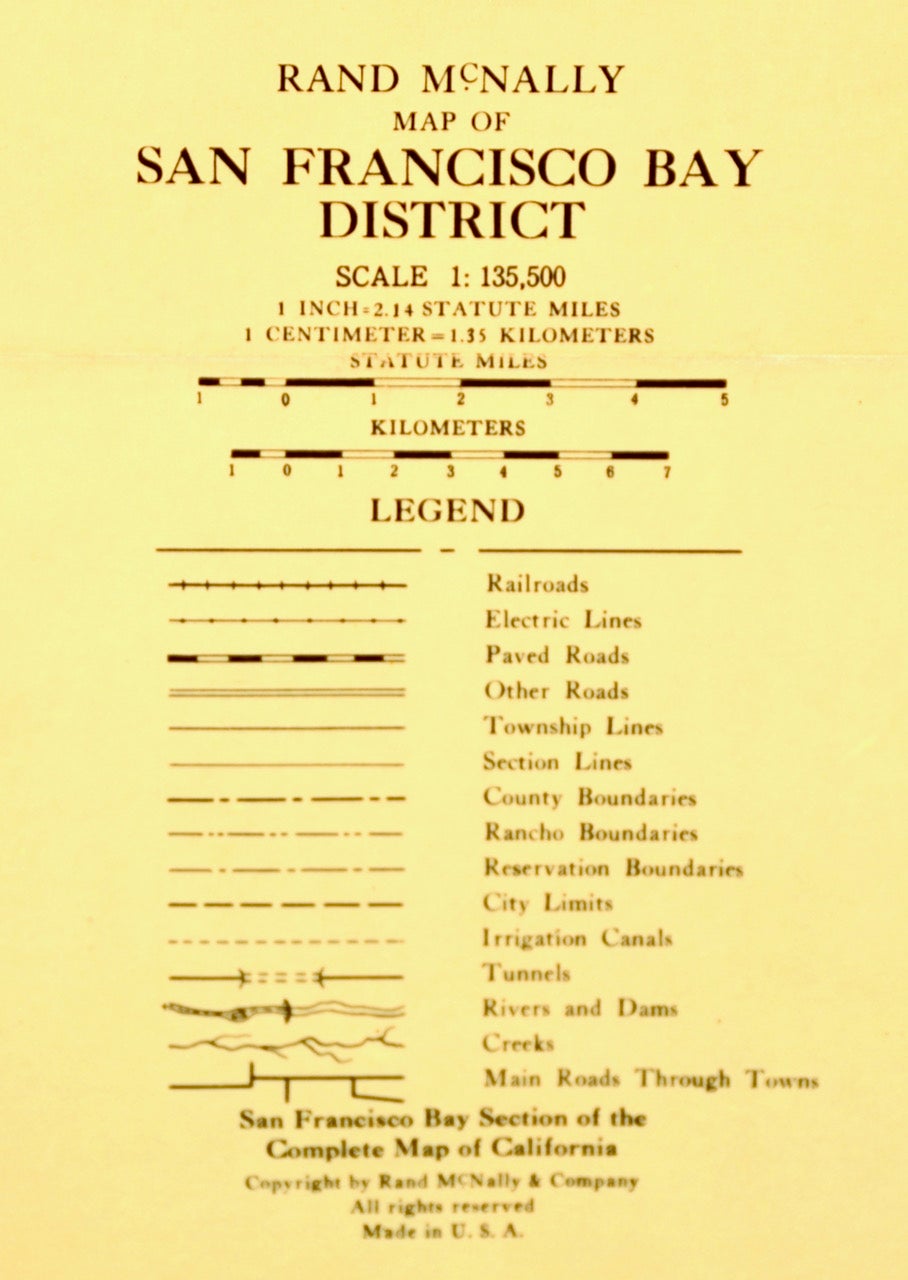
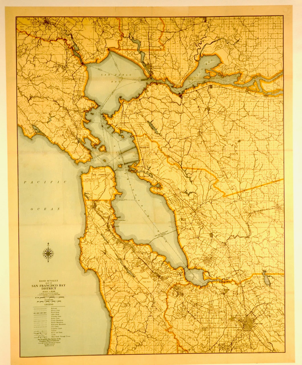
1928 ORIGINAL MAP: SAN FRANCISCO BAY AREA / LINEN-BACKED
Chicago: Rand McNally & Co., 1928. This is an ORIGINAL map of the SAN FRANCISCO BAY DISTRICT. 1928. Expertly linen-backed for restoration and ease of handling. 32 1/4" x 26 1/4" plus white border. Color. Note: There is no Golden Gate Bridge. There are two drawn lines representing purposed Bay Bridge routes; one approaching what was to become Treasure Island. OCLC/WorldCat lists but two copies, at the California Historical Socierty and Stanford University. Near Fine; certainly suitable for framing. FREE SHIPPING to any United States address. Item #2733
Price: $250.00