
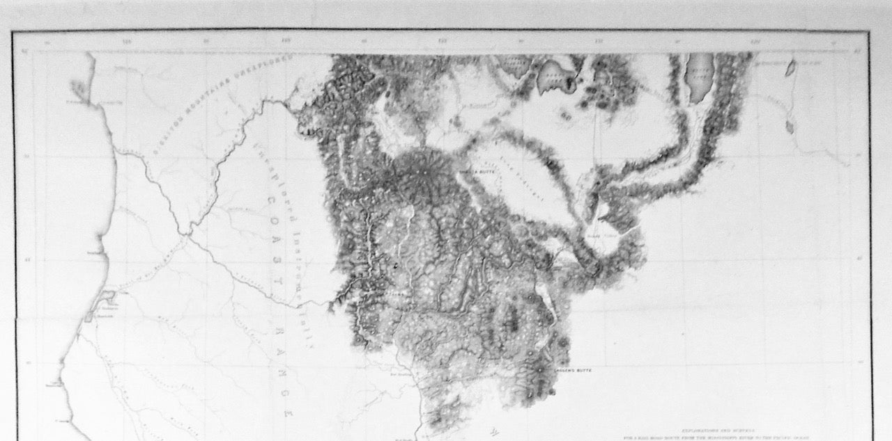
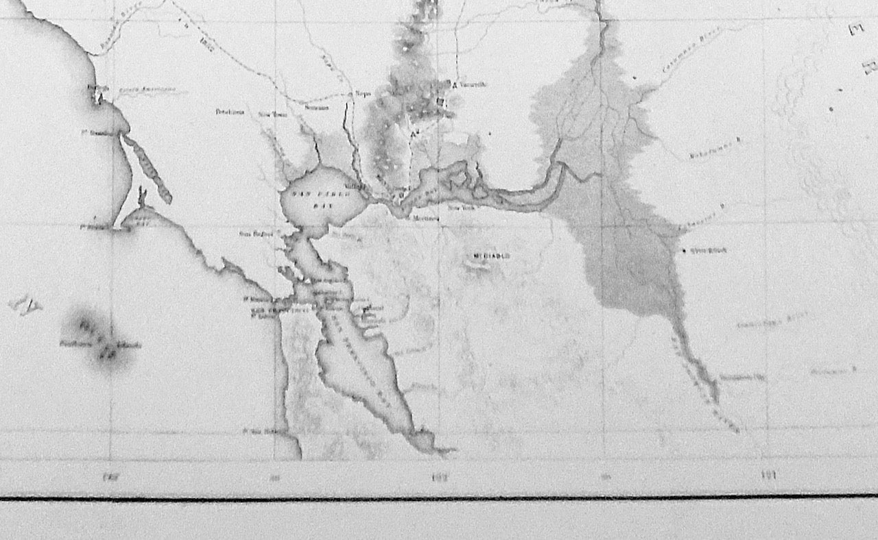
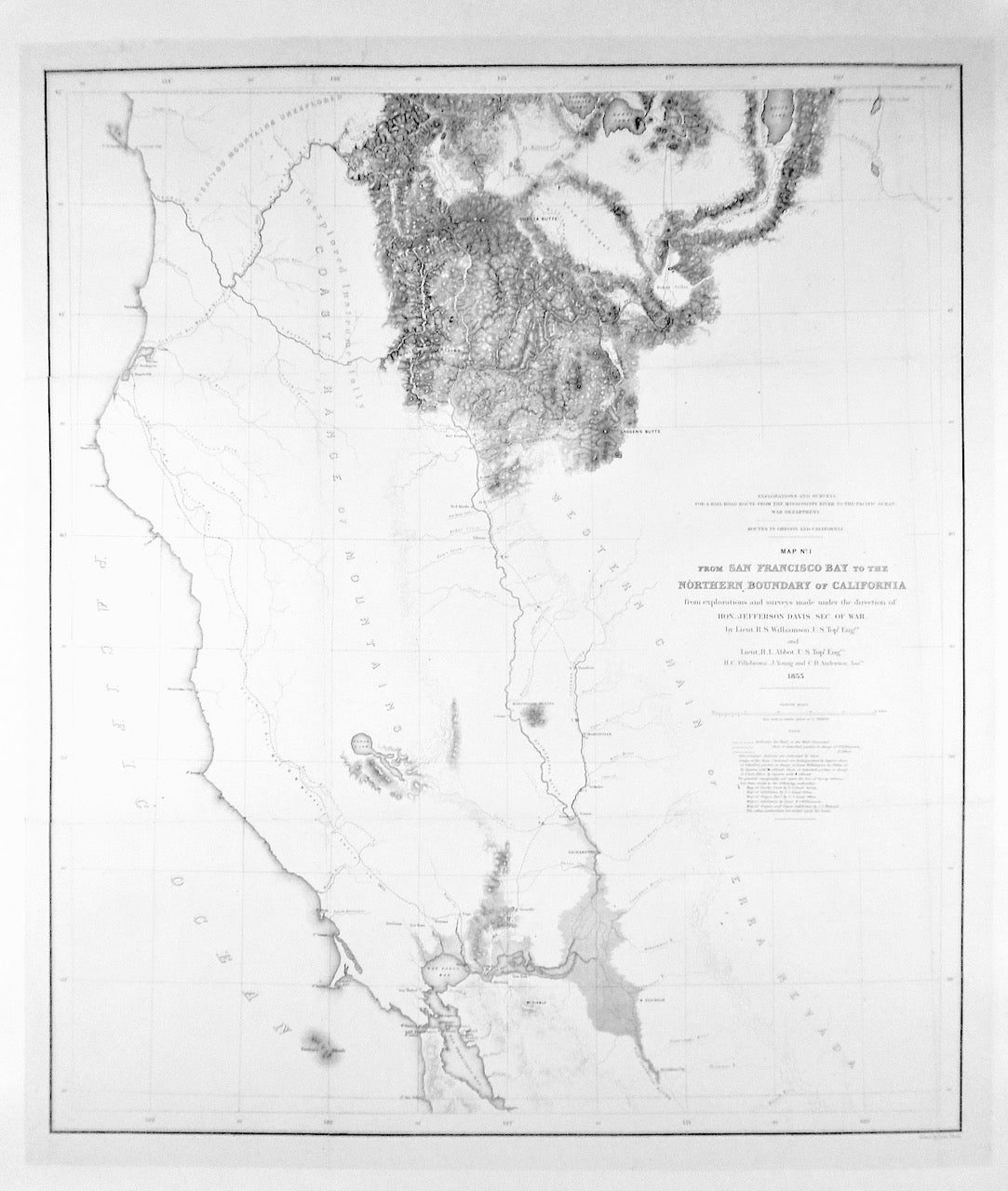
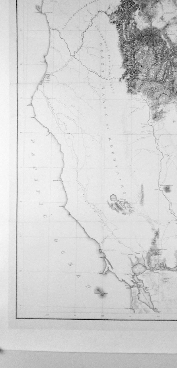
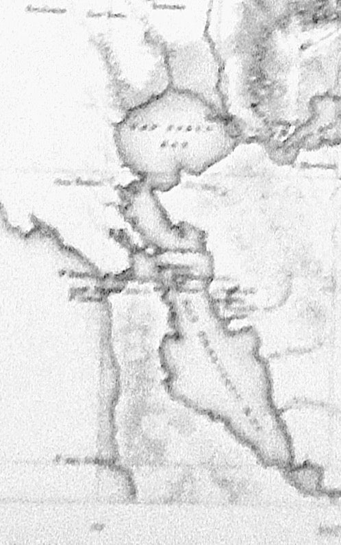
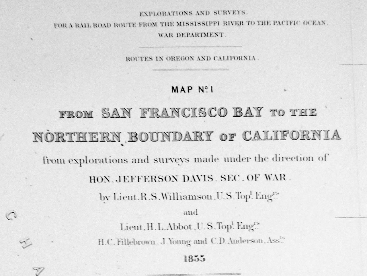
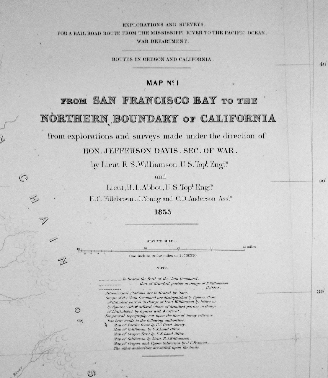
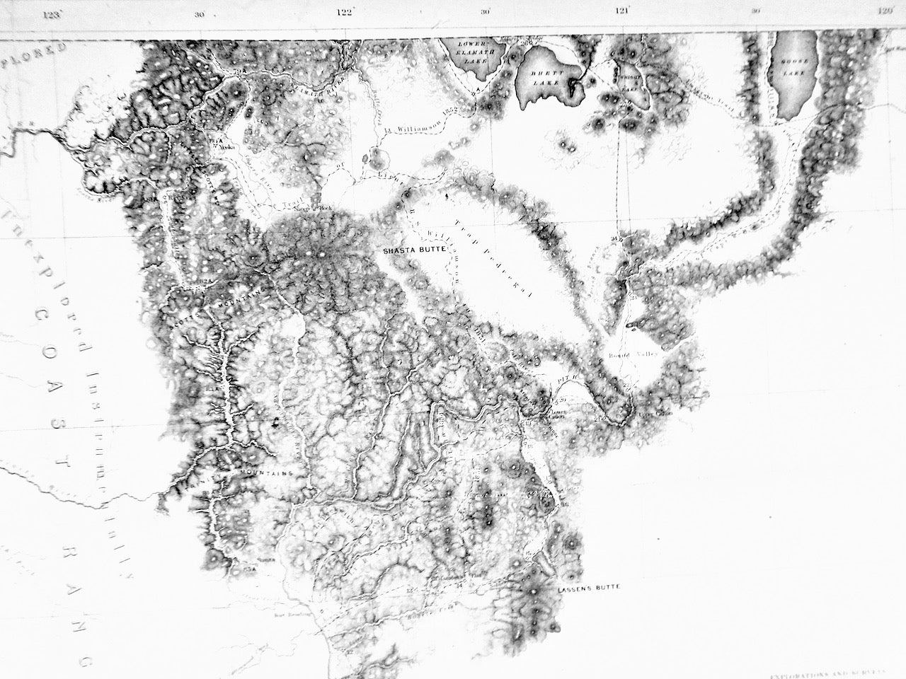
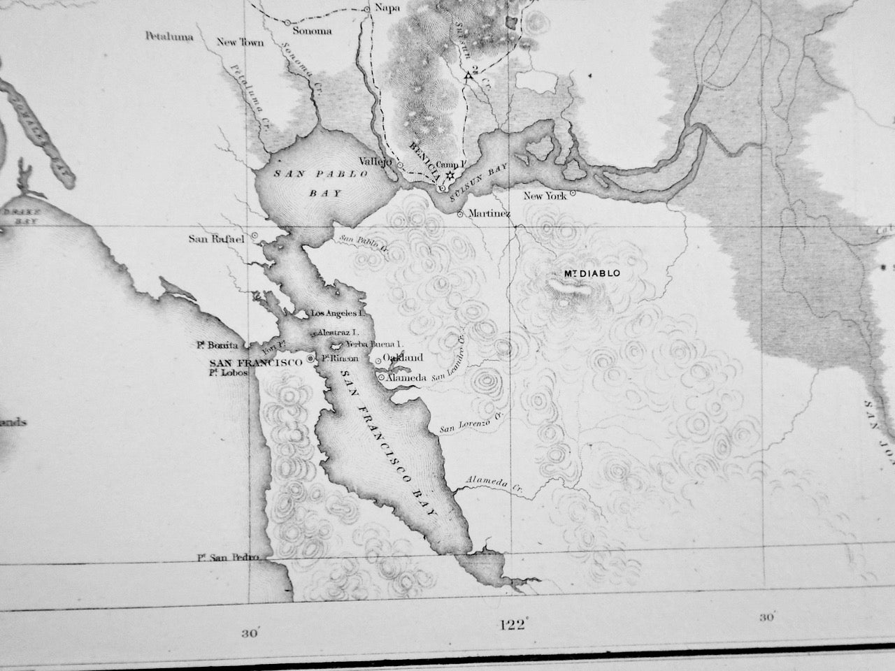
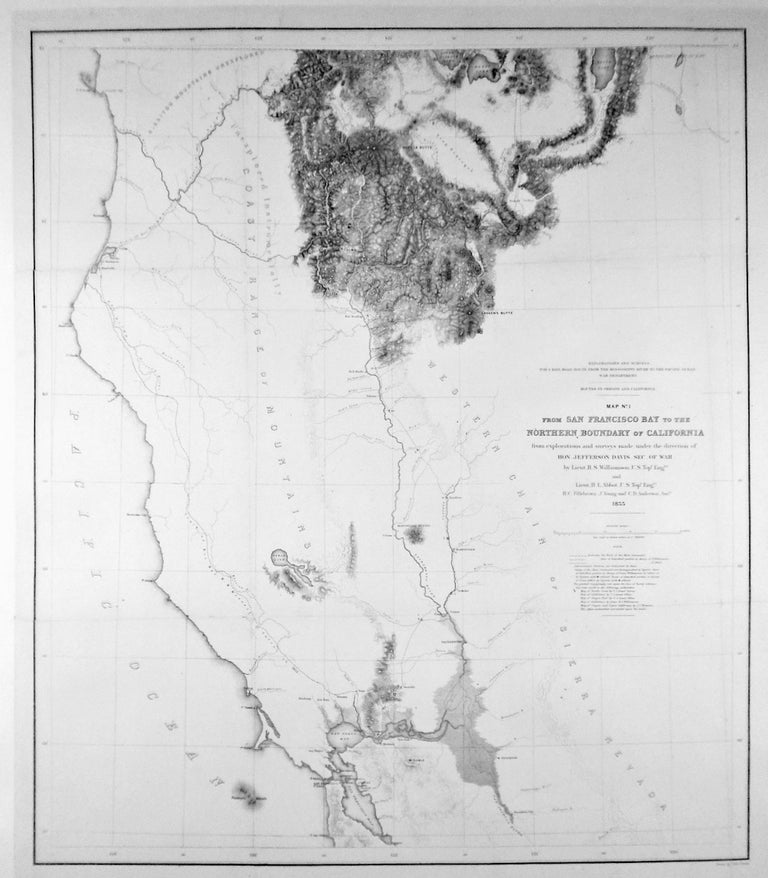
1855 ORIGINAL MAP: "FROM SAN FRANCISCO BAY TO THE NORTHERN BOUNDARY OF CALIFORNIA" / MAP NO, 1 / LINEN-BACKED
Washington D.C. United States War Department, 1855. First Edition. This is an ORIGINAL map: "FROM SAN FRANCISCO BAY TO THE NORTH BOUNDARY OF CALIFORNIA / MAP NO. 1". 1855. Image: 27 1/4" x 23"plus 1 1/2" border. Linen-backed for preservation and ease of handling. Map created from exploration and surveys for a railroad route from the Mississippi River to the Pacific Ocean made under the direction of "Hon. Jefferson Davis, Sec. of War" (Later, President, C.S.A.). By Lt. R. S. Williamson and Lt. H. L. Abbot. Shows the physical features as well as existing roads and tracks of explorers, including the Emigrant Trail, Warner, Williamson, Wessell and John C. Fremont. Wheat, Transmississippi 882. An important map. Near Fine. FREE SHIPPING (rolled) to any United States address. Near Fine. Item #2741
Price: $350.00